For over a thousand years, Skellig Michael was defined by the silence of its monastic settlement. However, the 19th century brought a different kind of inhabitant to the island: the lighthouse keepers. These men and their families moved onto this exposed Atlantic outpost not for spiritual isolation, but to guide ships safely through one of the most dangerous stretches of the Atlantic coast.
The lighthouses of Skellig Michael remain some of the most impressive feats of engineering on the Irish coast. They represent a period when the island transitioned from a place of medieval pilgrimage to an important point on Atlantic shipping routes. For modern visitors, the legacy of the lighthouse era is just as visible as the monastic ruins, shaping the very paths used to explore the site today.
A New Era for the Island
In the early 1800s, the waters off the southwest coast of Kerry were notoriously dangerous. The increase in transatlantic trade meant that more ships were navigating these Atlantic swells, often with disastrous results. To mitigate the risk, the Corporation for Preserving and Improving the Port of Dublin, commonly known as the Ballast Board, decided that a permanent light was required on the Skelligs.
Construction began in August 1821. The project was overseen by George Halpin, a celebrated civil engineer responsible for dozens of lighthouses around the Irish coast. Building on the island was difficult from the outset. Every piece of equipment, from stone to lantern components, had to be brought ashore and moved up from the landing point.
The project was completed in December 1826. Rather than a single light, Halpin designed a system of two lighthouses: the Upper Light and the Lower Light. This "double light" system was intended to help sailors distinguish Skellig Michael from other lights on the coast, such as Loop Head to the north or Cape Clear to the south.
Quick Facts: The 19th-Century Construction
| Feature | Detail |
|---|---|
| Construction Period | 1821 – 1826 |
| Lead Engineer | George Halpin |
| Authority | The Ballast Board |
| Number of Lights | Two (Upper and Lower) |
| Material | Rubble masonry with slate cladding |
| Total Cost | Over £45,000 |
The Upper and Lower Lights
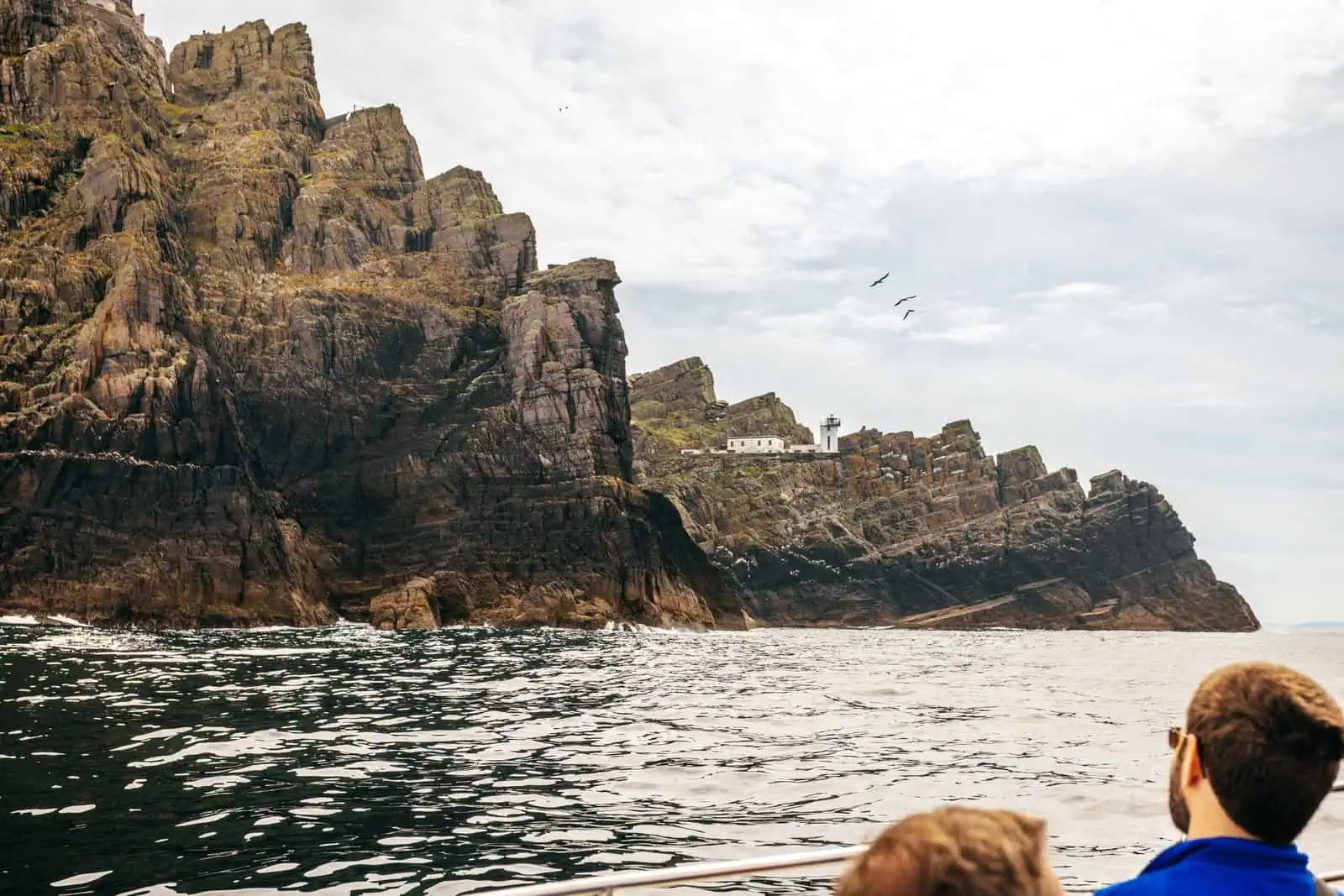
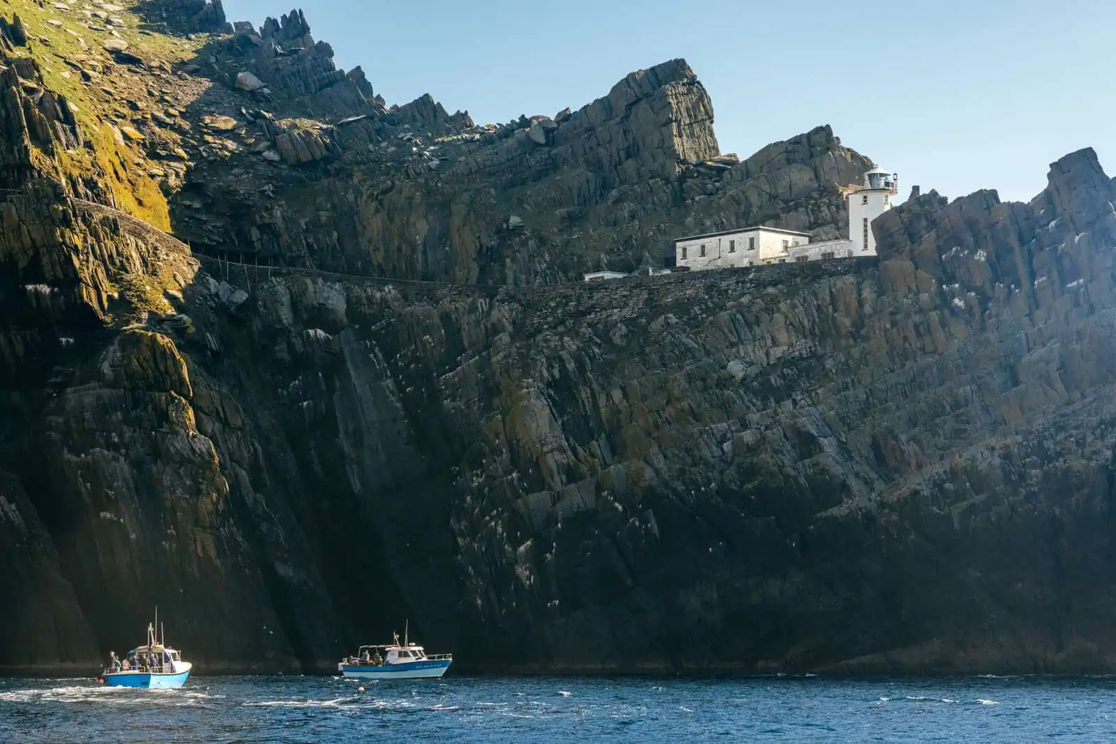
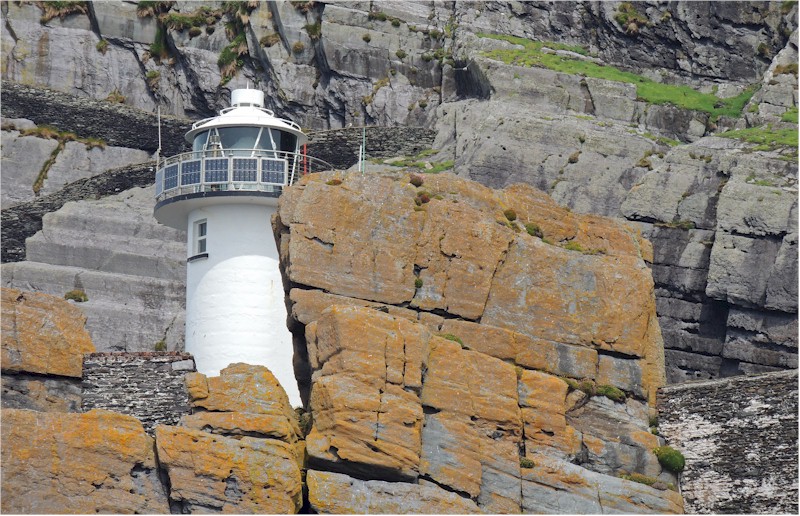
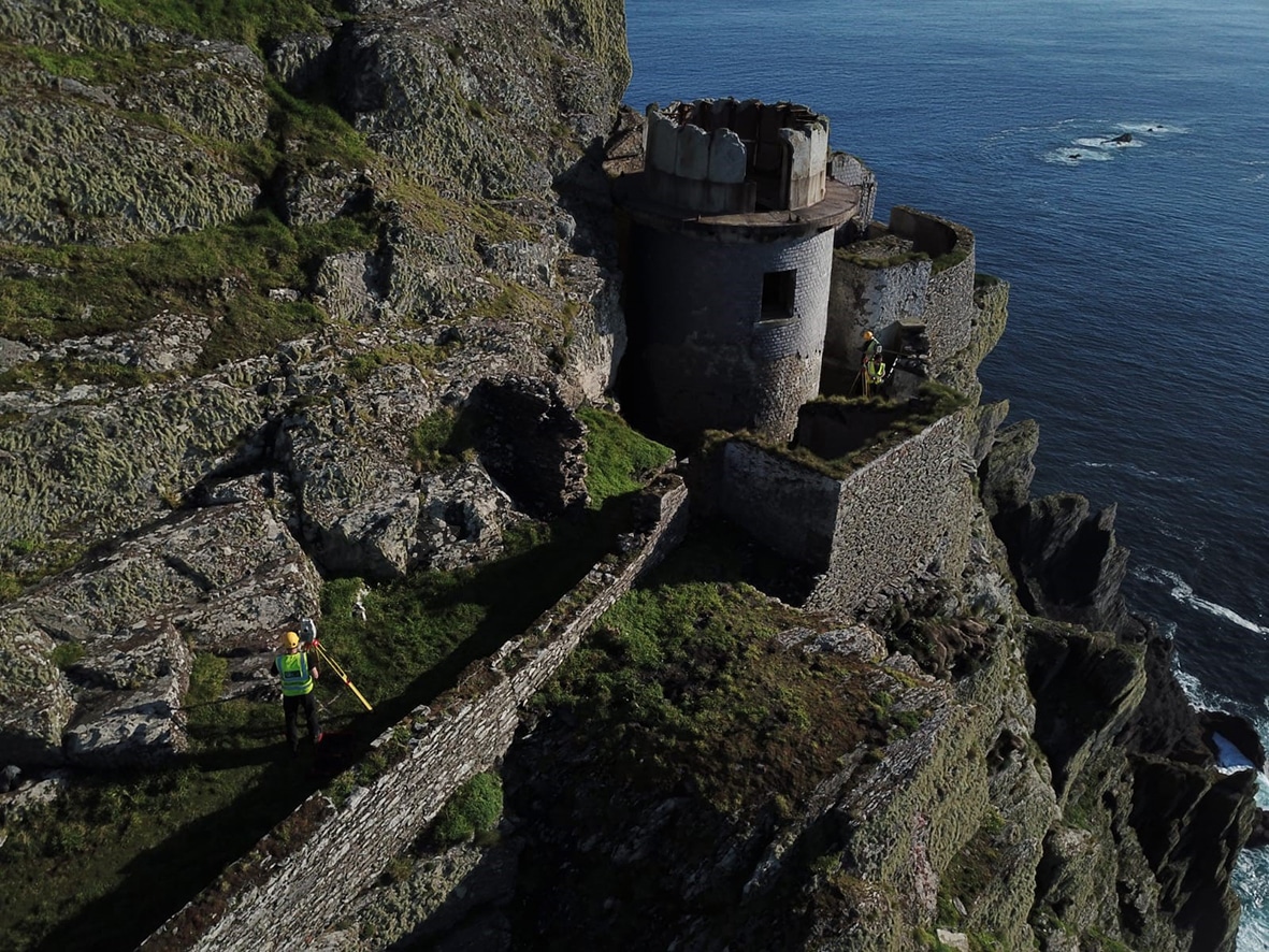
The two towers were positioned 227 metres apart on the Atlantic-facing side of the island. The Upper Light stood 121.3 metres above high water, while the Lower Light was situated significantly lower, at 53.3 metres. Both towers were approximately 14 metres tall, built from durable rubble masonry with slate cladding to withstand constant exposure to salt spray and Atlantic weather.
The Upper Light was designed to be the primary beacon, visible for up to 25 miles (40 kilometres). However, its height proved to be its downfall. Because it was so high up the cliff, it was frequently shrouded in low-hanging Atlantic clouds and fog, making it invisible to ships precisely when they needed it most.
In May 1870, after decades of operation, the Upper Light was discontinued. The decision coincided with the opening of a new lighthouse on Inishtearaght in the Blasket Islands. Today, the shell of the Upper Light remains a haunting landmark on the higher reaches of the island, a reminder of the practical difficulties of navigating the Kerry coast.
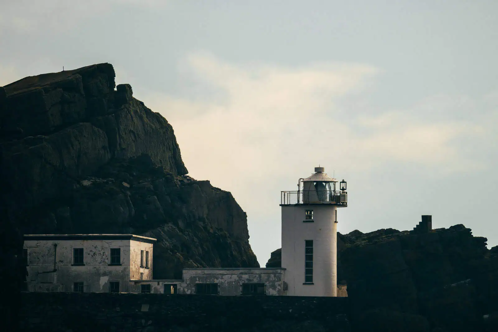
The Lower Light, however, continued its service. It was more reliable in heavy weather and remained the primary guiding light for vessels approaching the Irish mainland from the west.
The Lighthouse Road and its Impact
One of the most significant changes the Ballast Board brought to the island was the construction of the Lighthouse Road. Before the 1820s, the only way to move around the island was by using the narrow, steep stone stairs carved by the monks centuries earlier.
To facilitate the construction of the two towers, George Halpin’s team blasted a wide, relatively level road into the southern and western cliffs. This road allowed for the transport of materials and provided the keepers with a safer route between the landing area and their dwellings. This marked the beginning of a permanent human presence on the island after the monastic period had ended.
The construction of this road was a double-edged sword. While it made the island more accessible, the engineering work cut directly through portions of the original monastic site. Some of the ancient retaining walls and lower terraces were damaged or removed to make way for the 19th-century infrastructure.
Today, visitors who take a Skellig Michael Landing Tour usually walk along a significant portion of this road before starting the climb up the 618 steps. It makes the scale and steepness of the island immediately clear, with the Atlantic crashing hundreds of feet below the road's edge.
Living on the Atlantic Frontier
Life for lighthouse keepers and their families was isolated and demanding. Unlike many other Irish lighthouses where keepers lived on the mainland and commuted, the families on Skellig Michael lived on the island full-time during the mid-19th century.
The dwellings were semi-detached houses built near the towers. Life was governed by the maintenance of the lights: trimming wicks, polishing lenses, and ensuring the oil supply was steady. The families were almost entirely self-sufficient, though they relied on regular boat deliveries for coal, flour, and other essentials.
The environment was harsh. During winter gales, salt spray would coat the windows, and the sound of the wind and sea was constant. Despite this, children were raised here, and a small community existed on the island, miles from the nearest village on the mainland.
In the early 20th century, the system changed. The families were moved to houses on the mainland, and the keepers began a rotation system. They would spend several weeks on the island followed by a period of shore leave. This remained the standard practice for decades, creating a unique bond between the keepers and the local communities in Portmagee and Valentia Island.
Automation and Modern Maintenance
The era of the manned lighthouse came to an end in the late 20th century. Technological advancements meant that the lights could be monitored and operated remotely, removing the need for keepers to live in such extreme conditions.
The Lower Light was fully automated on 22 April 1987. Since then, the station has been unmanned. In the years following automation, the light was converted to solar power. This was a significant logistical shift, as it removed the need for large fuel deliveries, which were always risky in a highly exposed Atlantic environment.
The Commissioner of Irish Lights still maintains the station today. While the keepers are gone, the lighthouse remains an active aid to navigation. Its UNESCO World Heritage Site status ensures that any maintenance on the lighthouse structures is handled with extreme care to protect both the 19th-century engineering and the older monastic remains nearby.
Seeing the Lighthouses Today
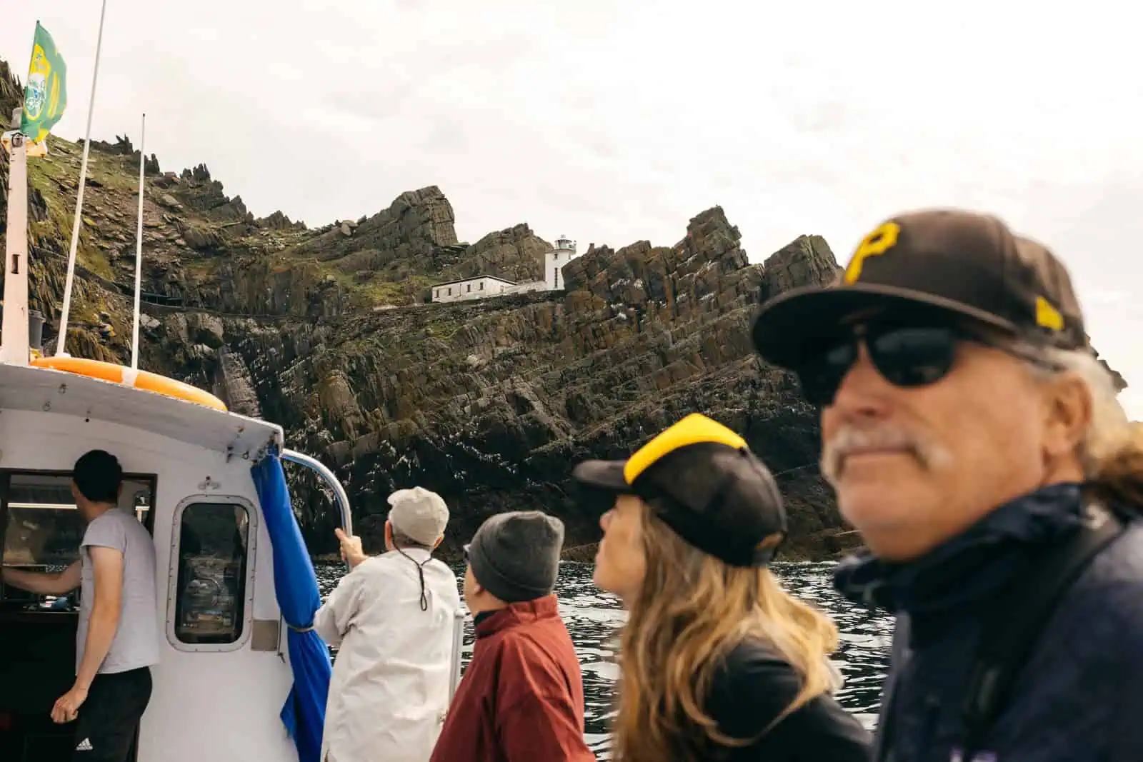
On our Skellig Michael boat tours, also known as eco tours, you can see the engineering that went into the Lighthouse Road. From the sea, you will notice how the road clings to the cliff face and how the towers are positioned to maximise visibility. This tour also offers views of the massive gannet colony on Little Skellig and the puffins that nest on the cliffs of Skellig Michael. You can sometimes see seals at the base of the rocks near the lighthouse landing area as well.
On the landing tour, you will walk along the lighthouse road to reach the start of the steps leading to the monastery. It is not possible to see the lighthouses when you are on Skellig Michael but the landing tour also circles the islands, when sea conditions permit, so you can see the lighthouses from the boat.